To follow up on my previous blog post, I wanted to pass along additional information on the projects that the Public Safety team worked on, as part of our week in the Holistic Testing lab. In addition to the ArcGIS Desktop GIS projects that were highlighted previously, we also had several people focused on ArcGIS Server (Web and Mobile) workflows to support the Public Safety community:
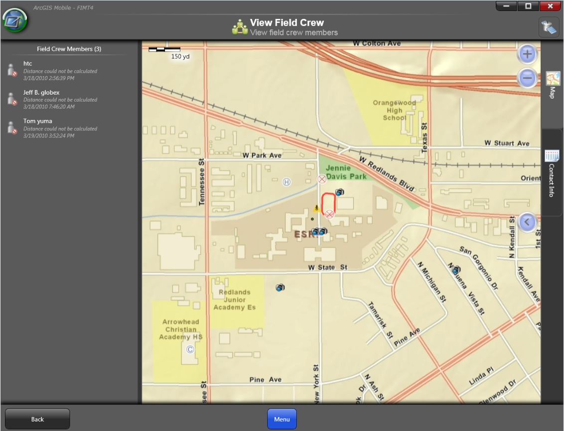
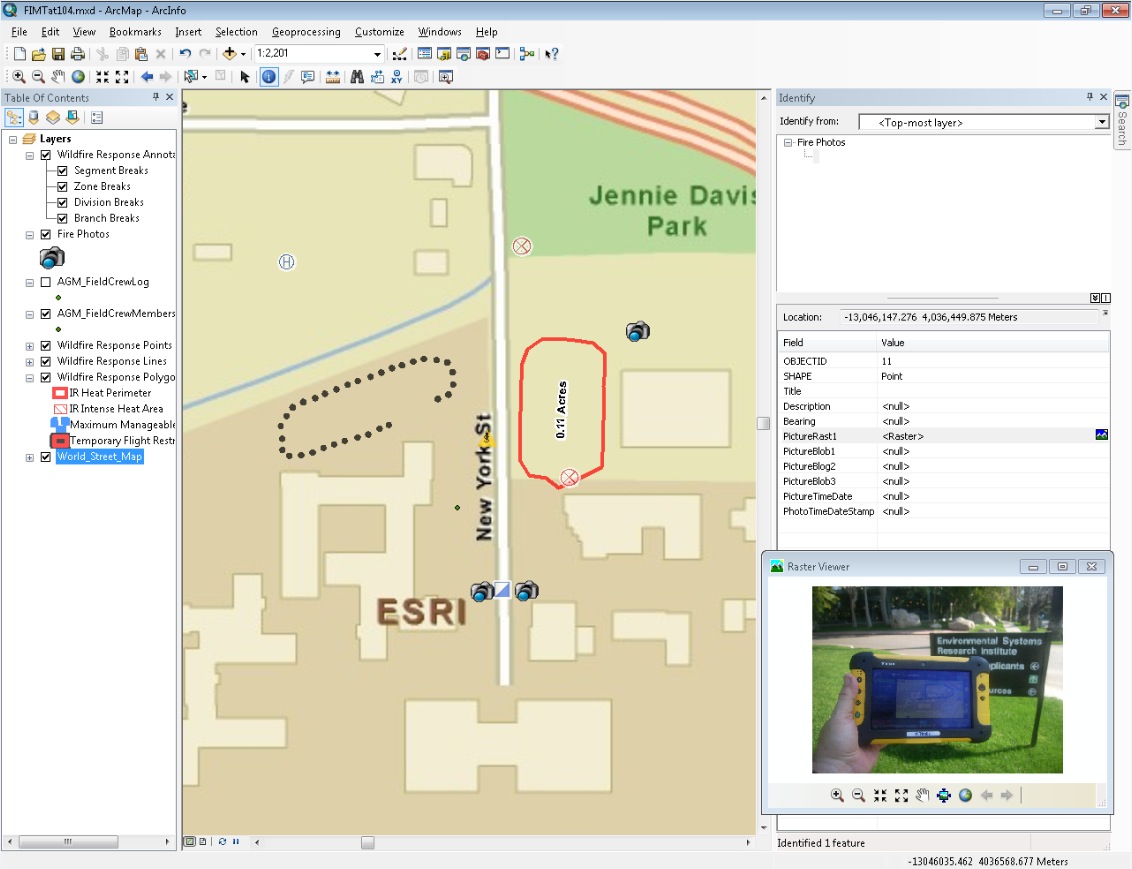
1. ArcGIS Mobile: ArcGIS 10 provides several enhancements on the mobile side that are important to public safety organizations. One significant addition is the ability to extent mobile projects to tablet-based PC’s using a ready-to-deploy app. This application supports a new “View Field Crew” task; being able to see the location of mobile workers both in the field and back in the command center/office is helpful to efficiently task teams to carry out the mission in addition to enhancing safety. Photos can also now be captured directly on the device and embedded inside the feature as either a Raster or Blob object. Check out the screen snapshots, below, for a quick look:
The mobile project application showing the field crew:Image may be NSFW.
Clik here to view.
A photo captured in the field displayed as a feature attribute in
Desktop:Image may be NSFW.
Clik here to view.
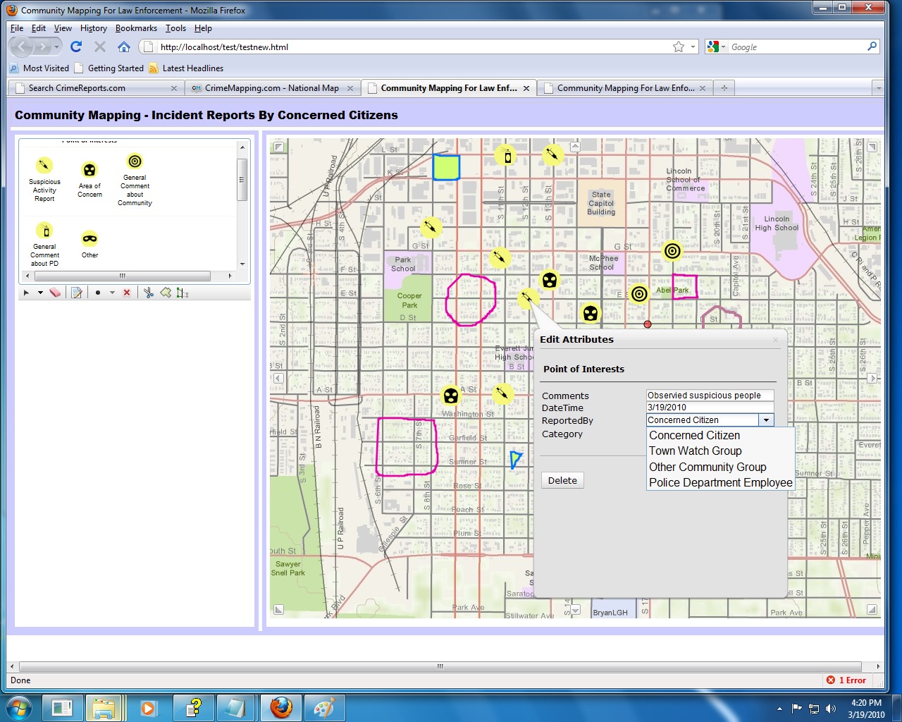
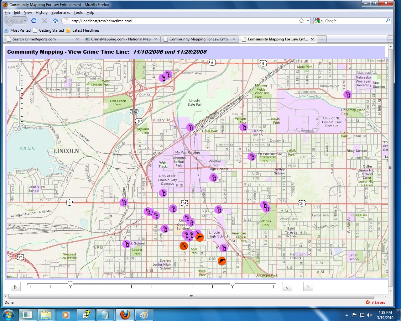
2. Web Apps using the JavaScript API: The new ArcGIS Server Web API for JavaScript (version 2.0) provides powerful new tools for building an effective community mapping Web app for Law Enforcement. Two exciting new features were tested: Feature Service and Time-Enabled Service. Using sample crime datasets, one tester created a Web application using the new JSAPI that would allow community members to report information by sketching on the map, and have this new data stored directly in a Geodatabase. It’s interesting to imagine how Law Enforcement agencies could use these new techniques to gather intelligence from the public; for example, a user could draw a single point location on the map to report suspicious activity, or sketch an outline of an area of concern and add comments. Also tested was the ability to use time-enabled services. A tool called “time slider” lets the user visually adjust the particular time window to determine what crimes are displayed on the map – this assists in understanding not only the spatial aspects of crime patterns, but temporal patterns as well. See the screen snapshots, below, of our early prototype:
Feature services allow simple user sketching to create data on a map:Image may be NSFW.
Clik here to view.The time-slider control lets users easily filter incidents based on date:Image may be NSFW.
Clik here to view.![]()
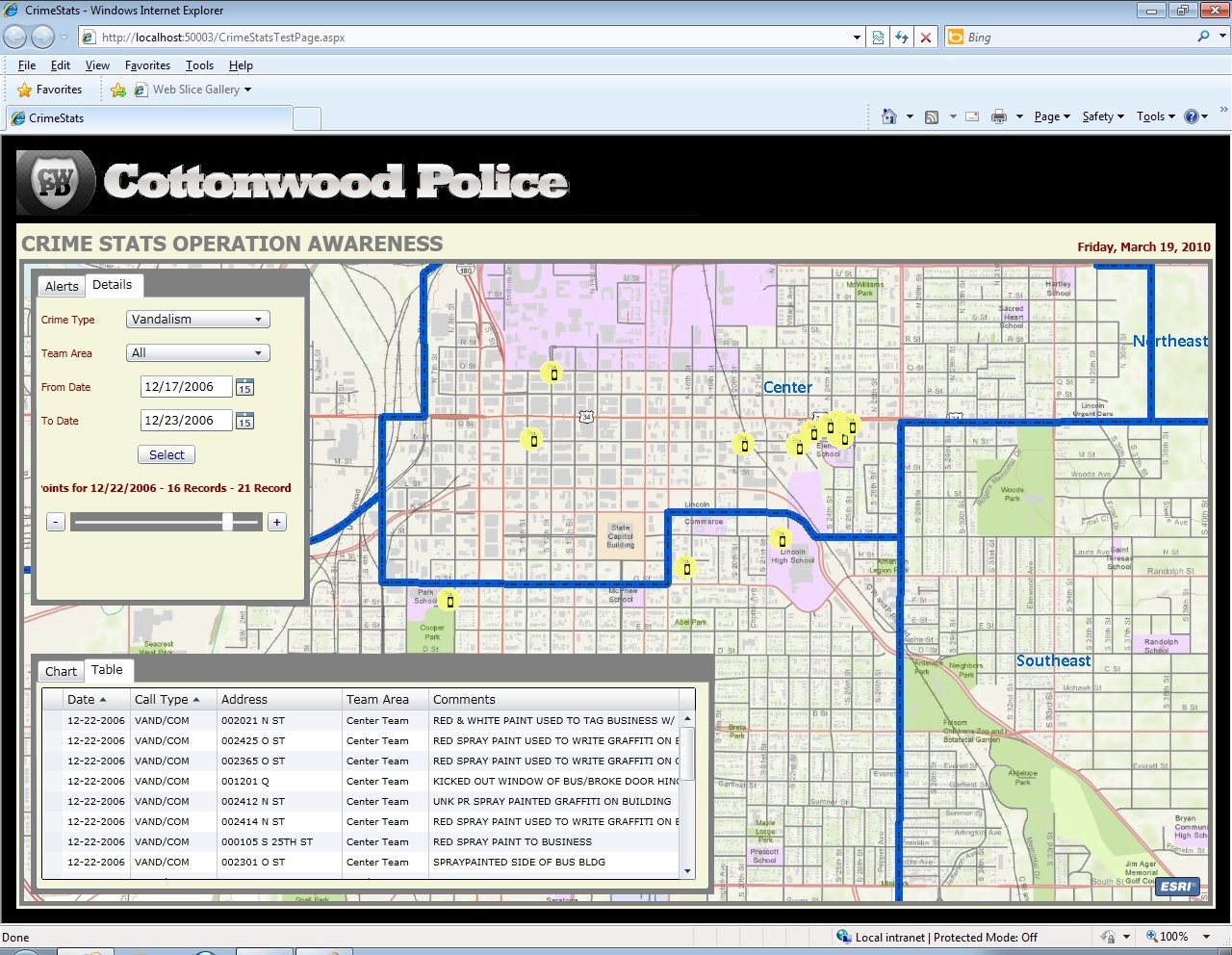
3. Web Apps using the Silverlight API: in addition to the JSAPI, we also had testers working on the newest version of the Silverlight API (version 2.0) and its potential applications in Law Enforcement. Of particular interest are the Feature Service and Time-Enabled Service (sound familiar?!). Our Silverlight testing focused on prototyping an internal Web app that officers within a Police Department would use for fairly typical crime analysis tasks – querying, mapping and charting – but we dressed things up a bit with a time-slider filter for the dates. Time-enabling the map, both in the Desktop and Server, is something that we see as a very compelling use-case, so we wanted to make sure we understood the process in several different client environments. You can see the screen snapshots of our results, below:
Performing a query results in a bi-directional bar chart and map, giving two views of the results:Image may be NSFW.
Clik here to view.![]()

The time-slider control filters the incidents by date, on the map and the data grid: Image may be NSFW.
Clik here to view.![]()
So this concludes the test of ArcGIS 10 for Public Safety! We hope that you find this informative, as you start looking forward to the next release and how it can help enhance your applications and workflows. As always, we look forward to your comments and suggestions.